


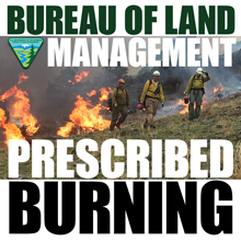
Fire crews from the Bureau of Land Management Applegate Field Office will conduct prescribed burns to reduce hazardous fuels in northeast California and northwest Nevada beginning in early October. Projects will occur only when weather and fuel conditions allow for safe and successful burning.
“The prescribed burns will help reduce the risk of catastrophic wildfire associated with high fuel loading. They will improve firefighter safety and effectiveness in the event of a wildfire,” said Dereck Wilson, manager of the BLM Northern California District.
“These burns will also help prevent wildfire damages to natural resources and communities within the Wildland Urban Interface, where homes are near public lands.”
The first project, set for approximately October 10th, will be carefully managed broadcast burns on approximately 800 acres of BLM-managed public lands along the Hogback Ridge, south of Fall River Mills. Smoke will be visible throughout the Burney Basin, Big Valley, and to motorists on State Route 299.
Additionally, prescribed pile burns will be implemented through the late fall, winter and spring, when adequate moisture is present. These projects will occur in Modoc County, northern Washoe County, northeastern Lassen County, and eastern Siskiyou County. Each project will be announced in advance.
Northeast California prescribed pile burns are as follows:
Modoc Gulch, four miles southeast of Dorris: 850 acres of piled juniper
Vya, Nev. projects, twenty miles northeast of Fort Bidwell: 3,600 acres of piled juniper
Twin Lakes, eighteen miles southeast of Cedarville: 700 acres of piled juniper
Rygrass Swale, 9 miles south of Alturas: 500 acres of piled juniper
XL, three miles northeast of Alturas: thirty acres of piled juniper
Dry Cow, five miles east of Madeline: 250 acres of piled juniper
Nelson Corral, six miles northwest of Madeline: fifty acres of piled juniper
These piles of brush, limbs and small trees are from projects to reduce hazardous fuels that could feed wildfires.


