


by Susan Couso
In 1821, Mexico won independence from Spain and possession of California and her Spanish missions quietly and smoothly came under Mexican control. But peace was not lasting. Within 25 years of the change of power, the Bear Flag Revolt sprang up among the non-Mexican citizens who had settled in the region.
The revolt began as emigrants, mainly from the eastern U.S., flooded California to seek their fortunes. The lush valleys and mountains teeming with wildlife, minerals and timber were coveted by those in power in the U.S. government, and emigration was encouraged to help claim the area for the U.S.
In June of 1846, a small group of men, reportedly prompted by General John C. Fremont, attacked the Mexican outpost at Sonoma, and the war was on. By 1848, when gold was discovered at Sutter’s mill in Coloma, California’s fate was sealed. Mexico could not compete with the U.S. forces.
On February 2, 1848, at the village of Guadalupe Hidalgo, the Treaty of Peace between the United States and the Republic of Mexico was signed, and the United States then had possession of a vast portion of land which stretched from the coast of California into the Rockies.
The treaty gave the U.S. 525,000 square miles of land, and also relinquished any Mexican claim to Texas. It further established the southern U.S./Mexican boundary as the Rio Grande. The U.S. gained all or part of present-day Arizona, California, Colorado, Nevada, New Mexico, Texas, Utah and Wyoming.
The huge new area conceded to the U.S. by Mexico had to be governed. The eastern limits of the area had never been designated by the Mexican government, and the ambiguous boundaries caused a problem for U.S. officials.
In 1849, as the California Constitutional Convention met at Monterey, they faced quite a few problems. They wanted immediate statehood for California. Some feared that if they set the eastern boundary too far into Utah Territory, it would make the new state too large, and statehood would be denied. The proposal to establish California’s eastern boundary at the 116th meridian would have placed it near the eastern border of today’s state of Nevada.
Eventually the borders of the proposed state were decided. The eastern line was drawn beginning at the 120th meridian at the border with Oregon. Then, it followed the 120th meridian south to the Lake Tahoe area before beginning a sharp angle towards the Colorado River. So, the boundary for California was set.
The state was admitted into the union on September 9, 1850, when California became the 31st state, and those Bear Flag proponents were later honored by having their Bear Flag design incorporated into the flag of the State of California.
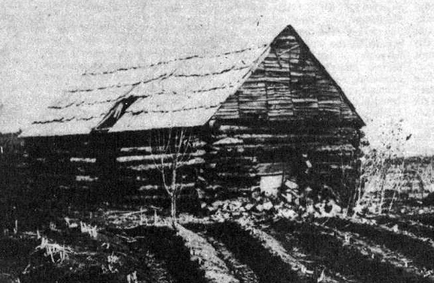
In 1853, Isaac Roop followed the Nobles Trail into Honey Lake Valley from the Redding area. He liked what he saw, took a land claim on the area, which is now the town of Susanville, and encouraged others to follow.
As the area was settled, problems with government oversight began. The high mountains created a barrier towards California, so the Honey Lakers naturally looked to the east for help, but the Honey Lake region was pretty much ignored by both California and Utah. Most locals knew that they were near the state boundary, but they weren’t sure just which side they were on. (Nevada Territory wasn’t established until 1861, and the state of Nevada was admitted in 1864.)
To put it rather ‘bluntly’, Utah, whose territory extended to the California line, didn’t want the Honey Lakers, and California wasn’t too excited about them either. So, feeling ignored by every surrounding government, the Honey Lakers decided to take measures into their own hands.
On April 26, 1856, about 25 of these men first met to try to create rules to help oversee their area. They first set about establishing laws for the protection of property. Property disputes were common as people made land and mining claims. The Honey Lakers considered themselves to be out of California’s jurisdiction, even if they were within its boundaries, so they felt that it was a natural step to create a new territory.
The new territory was to be called the Territory of Nataqua. ‘Nataqua’ has been described as a Native American word for ‘woman’, but that may or may not be the case. The idea of naming a territory ‘woman’ does seem a bit strange, but perhaps some wishful thinking was involved.
The Honey Lakers were ambitious. They laid out the boundaries of their new territory, and these boundaries began at California’s eastern border and extended eastward for 155 miles, ending at the 116th meridian. From the Oregon border, the new territory projected south for 240 miles, taking in the unsuspecting inhabitants of the Eagle, Carson, and Washoe Valleys.
To add to the confusion, the Honey Lakers, not really knowing where they were, did not include Honey Lake Valley within the boundary lines. Susanville is about 35 or so miles from California’s eastern boundary (or the beginning of the Nataqua Territory).
All-in-all, the Nataqua Territory, with Peter Lassen as President and Isaac Roop as Secretary, did not survive. They were ridiculed wherever newspapers needed an amusing story about the ignorant Honey Lakers who did not know where they were and accused of illegal dealings by those who were irritated by their actions.
Atlas Fredonyer, in a scathing letter to William Kibbe, Adjutant General of California, pleaded for the state to send troops to quash the Honey Lakers, which he described as an “organized band of ruffians”, naming Peter Lassen as a “cattle finder” and Isaac Roop as “absconder, debtor and sharp.”
Quietly the Nataqua Territory faded away, and was completely wiped out when Isaac Roop, resident of Susanville, California, became the first governor of the Territory of Nevada. Clearly, confusion was rampant.


